Sea level is rising.
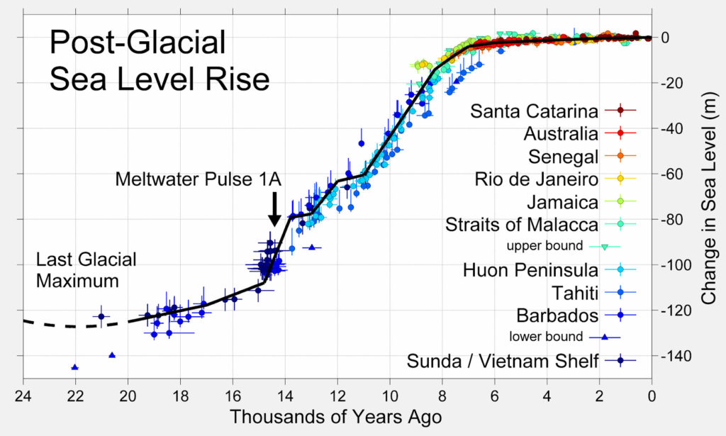
First of all, the context. Since the last ice age maximum (about 20,000 years ago) the sea has risen by about 100 meters, as ice sheets and glaciers world-wide melted. But for about the last 7,000 years the level has been pretty stable.
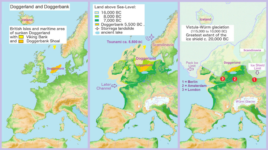
This is illustrated in more local history: at the time of the last ice age Doggerland was a huge area between Britain and Denmark; as the ice retreated and the sea level rose, it shrank, forming a marshy land round the perimeter of the Low Countries and the East coast of the UK.
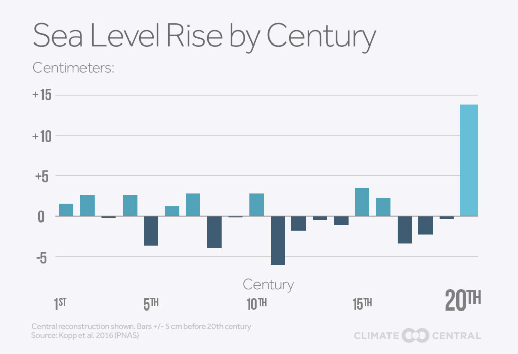
Which brings us to recent times. Careful analysis of a variety of records demonstrates that over a couple of milennia of modest changes in sea level - upwards and downwards - the 20th century has seen the vast majority of rise in that period.
It is virtually without doubt that this has been caused by the burning of fossil fuels. The CO2 emissions from this has caused warming of the atmosphere (due to the 'enhanced greenhouse effect') and in turn sea level rise, for two main reasons:
- The melting of ice sheets and glaciers, especially in Greenland and Antarctica.
- The warming of the sea as it absorbs increased heat from the atmosphere, causing it to expand slightly.
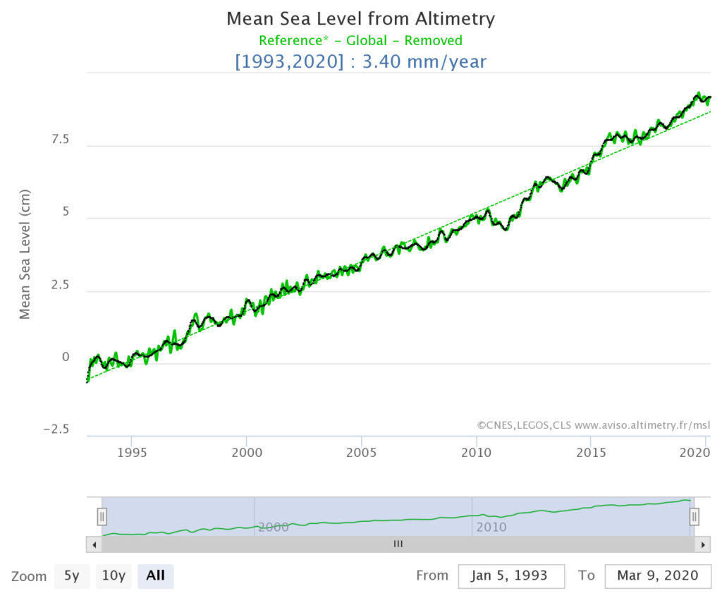
The result is a rise in mean global sea levels currently of about 3.4 mm per year. There are variations from place to place due to the wind, localised warming effects, and local melting of ice.
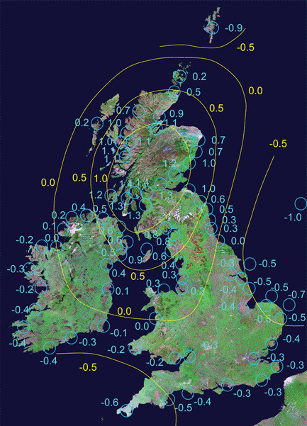
To complicate matters, there is another factor going on – adjustment of land levels following the removal of the ice mass 7,000 years ago. This map shows that Southern Ireland and Wales, and Southern and Eastern England are continuing to sink, whilst Scotland is rising, at rates less than previously predicted. This effect, in the region of 1mm per annum is, however, not as pronounced as sea level rise.
The short version is therefore that the sea level is currently rising round the UK coast at about 3 or 4 mm a year, i.e. 30 cm (roughly a foot) a century. There is every reason to believe that this rate will accelerate, however, as covered in our post on Forecasting Future Sea Levels. And even more to the point, we start to explore here what the impact of this is likely to be on the coast.


